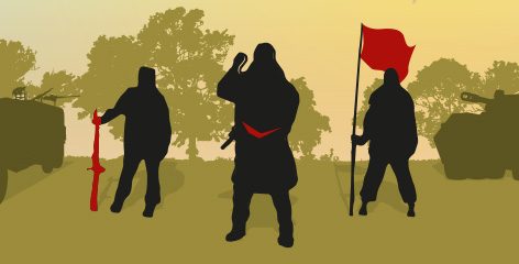
ARI on TwitterARI on LinkedinARI on FacebookARI on iTunesARI RSS Feed

On the periphery: Missing urbanisation in Zimbabwe

On the periphery: Missing Urbanisation in Zimbabwe By Beacon Mbiba

Zimbabwe’s 2012 census report suggests that notable de-urbanisation occurred between 2002 and 2012. Some external commentators have cited urban–rural migration and the Fast Track Land Reform Programme – jambanja – initiated in 2000 as the principal drivers of this phenomenon. During field research in the second half of 2016, I found that ordinary citizens and key informants – in politics, government and civil society – expressed bewilderment at suggestions that the country is de-urbanising. While the populations of the large cities appear to be growing slowly, if at all, unadjusted boundaries mean that the demographic growth associated with urban sprawl has not been captured. In-depth analysis also reveals rapid population growth in peri-urban areas that should be designated as urban, and in small and intermediate urban settlements.

Overestimation of the urban populations, and the rate at which urbanisation levels are increasing in African countries, is a consistent feature of international organisation reports.1 But for Zimbabwe, underestimation seems to have occurred. While the rate of urbanisation may have slowed, the extent of the slowdown appears exaggerated and it is likely to be reversed when boundary changes are made. It is not inconceivable that Zimbabwe could still be majority urban by 2050.

By Beacon Mbiba

Africa’s “rapid urbanisation” is controversial. In a provocatively titled 2010 Counterpoint, “Whatever happened to Africa’s rapid urbanisation?”, and elsewhere, Deborah Potts has provided irrefutable evidence that it is a flawed generalisation.2 In a significant number of countries the urbanisation level – the percentage of the population living in urban areas – has declined since the 1990s due to economic crises, de-industrialisation, epidemics or other causes. Furthermore, notable within- and between-country variations prevail.

Potts has shown convincingly that, despite abundant examples of countries experiencing rapid urban population growth but only gradual increases – or declines – in their overall urbanisation level, promotion of the “rapid urbanisation” narrative continues unabated. Flagship reports from leading international agencies including the World Bank and UN-Habitat have been slow to fully take this research data on board or have done so grudgingly. Most recently, the 2016 edition of the authoritative African Economic Outlook asserted that “Africa is urbanising at a historically rapid rate, bringing considerable opportunities and challenges”.3

Clearly, Africa’s urban population is increasing in absolute terms – in many countries, rapidly. Contention arises, in part, due to confusion of terms. “Urban growth” is equated to “urbanisation”, but there is an important distinction to bear in mind. Urban growth is the increase in urban population that occurs as a result of any or a combination of rural–urban migration, natural increase, boundary changes or reclassification of rural villages or territories into urban areas. Urbanisation occurs when population growth in urban areas exceeds that of the total national population. If urban and rural populations are growing at the same rate, urban growth is occurring, but not urbanisation. The distinction is about more than semantics: a decline in the proportion of the total population living in towns and urban settlements, signifying counter- or de-urbanisation, has important policy implications that should not be overlooked.

To its credit, in the State of African Cities 2014 report, and more forcefully in the Habitat III Regional Report for Africa, UN-Habitat accepted that urban population growth rates relative to national population growth rates are stagnant or very slow in many countries and regional variations are the norm. Furthermore, the average rate of urbanisation in 1990–2015 was below 2% for the majority of countries (see Figure 1). Despite saying that Africa is urbanising at a rapid rate, African Economic Outlook 2016 presents data for selected countries where only three – Burkina Faso, Cameroon and Tanzania – are categorised as having rapidly urbanised between 1980 and 2012. Seven are presented as typical of slow urbanisation of below 2% between censuses, while another five are presented as de-urbanising.4 Zimbabwe, together with Zambia, Mali, Côte d’Ivoire and Central African Republic, is one of the countries flagged as experiencing de-urbanisation; and it features prominently in analyses of de-urbanisation in the 1990s.5

While accepting Potts’s exhortation to be wary of urban statistics and sceptical of the rapid urbanisation narrative, this Counterpoint urges that the pendulum should not swing completely to the other extreme. Rigorous analysis of evidence cited in support of de-urbanisation is also required. In the case of Zimbabwe, the de-urbanisation apparent in headline census figures since the 1990s seems to be exaggerated. De-urbanisation is not necessarily permanent – it can be reversed. Furthermore, although demographic and spatial conceptions of urbanisation are central to this discussion, it must be remembered that urbanisation also has economic, socio-cultural, political, infrastructural and services dimensions.

Figure 1: Real urbanisation growth rates in Africa, 1990 – 2015


Figure 1

Source: Plotted by author using data from UN DESA World Urbanization Prospects: The 2014 Revision

Zimbabwe – the headline figures

Zimbabwe’s most recent census, conducted in 2012, found that the share of the urban population had declined from 35% of the total population in 2002 to 33%, indicating that the country had de-urbanised during the decade. Unlike other African countries where censuses have been erratic, or their results highly contested, Zimbabwe has conducted regular, credible censuses involving and endorsed by leading UN and other donor agencies. It is a data-rich country, although access to the disaggregated local area data has been difficult in recent years and extrapolation is sometimes required.

The headline figures have certainly attracted attention. During field research in the second half of 2016, I found that ordinary citizens and my key informants expressed bewilderment at suggestions that Zimbabwe is de-urbanising. In seeking an explanation for why the country should have seemingly experienced de-urbanisation, the Mo Ibrahim Foundation stated that it had been “driven by urban–rural migration” and that “a growing share of the population living in communal land and resettlement areas [suggested] de-urbanisation is being driven by the land resettlement programme”.6

The causal link between the Government of Zimbabwe’s Fast Track Land Reform Programme (FTLRP) – or jambanja – and de-urbanisation needs careful interrogation. De-urbanisation was also observed in the previous intercensal period in the 1990s, long before jambanja. The reasons cited then included urban economic decline, household responses to HIV/AIDS, and the collapse of urban services, with retrenched workers and the terminally ill retreating to rural areas.7 Jambanja and its socio-economic consequences remain highly contested, and their impact on urbanisation poorly understood. Whether Zimbabwe is really de-urbanising and, if so, to what extent jambanja has contributed to the process will require deeper investigation.

BACK TO CONTENTS

Urban Zimbabwe

Zimbabwe’s national settlement framework has a seven-tier hierarchy of human settlements comprising metropolitan areas (Harare and Bulawayo), cities or municipalities, towns, and as many as 472 small urban centres in the form of “growth points”, district service centres and rural service centres. The official definition of an urban area in Zimbabwe is based on a combination of two criteria: namely a settlement designated as urban; and a compact settlement of 2,500 people or more, the majority of whom are employed in non-farm employment.8 Given the rural location of district and rural service centres, the Zimbabwe National Statistics Agency (ZIMSTAT) categorises them as rural even if their population is above the 2,500 threshold – unless they have been reclassified as urban/towns, as was recently the case with Gokwe and Gutu Mupandawana. Similarly, among my key informants flummoxed by the suggestion that Zimbabwe is de-urbanising, the perception of “urban” excluded these small urban settlements.

In 2002, Zimbabwe had an urban population of 4,029,707 which grew by 6.31% to 4,284,145 in 2012, an increase of 0.63% per year. Unlike the 2002 census report, the 2012 report has no chapter devoted to urban population and migration data. As with all censuses, some discrepancies and anomalies are apparent. For example, it states that the urban population of Zimbabwe was 4,284,145;9 but if one adds the totals in each province for the “Urban Council Area population” plus “Growth Points and other Areas”, the total comes to 4,261,243.10 More significant is the information, based on the above-mentioned additions, that the urban population for Mashonaland Central Province is 71,332. This is a substantial decrease from the figure of 102,873 in the 2002 census report.11 Enquiries with ZIMSTAT indicate that these are discrepancies for which they have not found an explanation. Why should Mashonaland Central Province’s urban population decline to this extent considering that this is the same region in which towns like Mvurwi are reportedly booming?12

Such anomalies aside, it is clear that the census totals signify quite slow growth in the number of urban dwellers. Between 2002 and 2012, the rural population increased by 15.46% compared to 6.31% for urban areas. A comparison of distribution of urban populations by province also shows minor changes between 2002 and 2012. There was a slight decline in Bulawayo’s share; and Harare accounted for 47% of the national urban population in 2012 (35% if Epworth and Chitungwiza are separated out), versus 46% in 2002 (36% if Epworth and Chitungwiza are separated out). In other words, according to these data the primacy of the capital, including its peri-urban satellite urban areas, increased slightly during the decade. The intercensal population change for the major urban areas is displayed in Figure 2, and for the provinces in Figure 3.

The difference between the growth rates of rural and urban populations can in part be attributed to higher total fertility rates in rural areas compared to urban areas. Total fertility rates of 2.8 for Bulawayo and 3.1 for Harare are much lower than the range of 3.6–4.3 for the other provinces.13 However, as the base population is large in the main cities, lower natural increase rates still result in significant aggregate population growth before we take migration into account.

Two further factors also need to be considered when analysing the urban population data: national and international migration patterns, and the impact of boundary changes or rigidity, addressed in more detail later. Although the census report states that internal migration patterns between the 2002 and 2012 censuses should be treated with caution as some provinces changed boundaries, some headline migration figures need mentioning. Zimbabwe has ten provinces including the urban provinces of Harare and Bulawayo. Lifetime interprovincial migration data show that Harare and Bulawayo “exhibited the highest in-migration rates” of 49% each, that is to say the percentage of people born outside these two urban provinces but resident there on census day. The report states that Harare was “the largest net gainer of population” from net migration, which accounted for 21% of its population on census day.14 Furthermore, Harare and Bulawayo exhibited the highest intercensal in-migration rate of slightly over 30%15 and net migration rates of 5.12% and 4.18% respectively, compared to negative net migration rates for five of the ten provinces.16 These statistics on internal intercensal migration do not attest to large-scale urban–rural migration.

Finally, therefore, it is important to recognise that although Zimbabwe’s demographic urbanisation rate may not be increasing, there is absolute urban population growth. As I will illustrate later in this Counterpoint, there is also significant urban spatial growth.


Figure 2: Population growth in Zimbabwe’s towns and cities, 2002 – 2012

Source: plotted by author using data from ZIMSTAT 2002 and 2012 census reports


Figure 3: Population growth in Zimbabwe by province, 2002 – 2012

Source: plotted by author using data from ZIMSTATS 2002 and 2012 census reports


Local level population dynamics: growth and mobility

Although the census data on urbanisation and migration data are patchy, comparison of 2002 and 2012 urban statistics provides important insights on local-level changes. Figure 2 shows that except for Harare and a few other centres whose growth rates are low or even negative – as is the case for Bulawayo – there has been rapid population growth in small urban centres and peri-urban zones. On the face of it, while these figures fit global trends that show declining rates of urban growth as economies mature, on closer inspection the Zimbabwe story is more complex. This is where jambanja needs to be considered.

The initial impact of Zimbabwe’s violent land reform was internal displacement of thousands of former commercial farm workers, the majority of whom became homeless and sought shelter and livelihoods in urban and peri-urban areas.17 This process unfolded both before and after the 2002 census. But then came the “tsunami”, the military-style Operation Murambatsvina (“he/she who despises filth”) in 2005, during which the state destroyed houses and small enterprises deemed illegal. Hundreds of thousands of urban and rural households were affected. The epicentre of these clearances was in low-income urban and peri-urban areas where most of those internally displaced by jambanja were sheltering. Thus jambanja and rural resettlement in some respects led initially to rural depopulation and urban growth, which Operation Murambatsvina partially reversed.

The deepening socio-economic crisis also led to increased mobility, as households sought to spread risks and maximise their chances of survival by operating in multiple geographical and economic zones. By 2004, most urban households – irrespective of political persuasion – had secured plots within 100km of their urban homes where they would travel periodically or have some family members resident to grow crops and increase their food security. Those in rural communal areas also made similar decisions for multi-sited livelihoods without necessarily abandoning their old homes.18 This mobility and circularity – individuals and families moving in and out of rural and urban areas and circulating between different locations mainly to pursue informal economic activity – must not be underestimated. A census only records where individuals are on the night of the census.

BACK TO CONTENTS

Jambanja and a housing stampede

The acute shortage of urban housing in Zimbabwe is well documented and widely acknowledged.19 High levels of overcrowding in existing stock, coupled with the government’s brutal restriction of squatter settlements, maintained the quintessentially European physical appearance of Zimbabwe’s urban areas for a long time after independence in 1980. All this collapsed with jambanja, as ZANU-PF elites used peri-urban land allocations to reward their supporters. The mechanisms of this patronage system took a variety of forms including politically aligned co-operatives. With jambanja, the bulk of peri-urban land that used to be privately owned farms became state land and legal obstacles to converting this land from rural to urban use were removed.

Initially, the majority of urban residents were hesitant about lining up for this land, but by 2010 a “stampede” was underway. A plethora of land dealers emerged who grabbed and allocated sites and/or plots for housing development.20 These included political elites, corrupt government officials and professionals, self-made land barons, churches and traditional leaders in peri-urban areas. Private land owners cashed in by subdividing their plots for sale. Villagers converted agricultural land to residential use to accommodate urban dwellers on a rental basis. In the process they also fenced off adjacent public land; for example, grazing land in Seke, Goromonzi and Domboshawa rural areas in peri-urban Harare, in a process popularly known as Operation Garawadya (“eat first then questions later”).

These developments cumulatively led to the rapid growth of small towns and satellite towns around Harare such as Ruwa and Norton, as well as the peri-urban areas of Seke and Domboshawa. Simultaneously, increasing mobility, informality and the rise of a trader society reinforced the growth of border towns including Kotwa, Beitbridge and Plumtree; and highway settlements, most of them small rural service centres such as Ngundu and Mhandamabgwe (both in Chivi District, on routes to South Africa).

In seeking to understand the dynamics of Zimbabwe’s urban development, the government’s response to the expanding urban sprawl throughout the country must also be considered. It has conspicuously not unleashed an operation similar to Murambatsvina. Instead, demolitions have been small-scale and targeted.21 At the same time, there has been an overhaul of the land and development regulations typified by the urban housing policy. Housing space standards have been reduced from a minimum plot size of 300m2 to as low as 100m2.22 With government and local authorities bankrupt, the development process has been opened up to anyone who appears to have the means to participate.

Crucially, houses can now be developed even where there is no approved land-use layout plan, no cadastral surveys and no infrastructure. All these factors have contributed to urban spatial growth in rural areas. They have also contributed to de-urbanisation in the sense of loss of urban character, namely, growth of urban areas lacking the infrastructure, services and institutions Zimbabweans would normally expect.

BACK TO CONTENTS

Boundary games

In a 2012 paper challenging myths of urban dynamics in sub-Saharan Africa, Potts underlined that much of the addition of large numbers of people to urban populations each year “appears to be increasingly derived from rural settlements being redefined as ‘urban’ having passed a definitional population threshold”.23 The Mo Ibrahim Foundation reported that in Kenya’s 2009 census, the re-classification of rural and peri-urban areas as urban led to a 29% upsurge in the urban population.24 Zimbabwe’s experience since the 1990s, however, has been different.

Instead of boundary changes to incorporate rural villages into urban areas, boundaries in Zimbabwe have remained static while urban sprawl and urban populations in rural jurisdictions have expanded. As a result, the 2012 census did not capture the urban demographic growth the spatial expansion has caused. The 2012 census enumeration tracts were aligned with the Zimbabwe Electoral Commission’s 2008 elections boundaries. Other than for political expediency, it is not clear why this was necessary; ordinarily, statistics from the previous census should drive the delimitation of election boundaries not the other way round. The fractious politics of the country means that changing boundaries – or leaving them unchanged – is more a political issue than a response to urgent urban management issues. Decisions are taken with an eye to electoral advantages that may accrue. This undermines direct comparison of the 2012 census data with those of previous censuses. Reviewing the census report indicates that boundary rigidity has led to urban populations of many small settlements and undesignated urban areas being counted and reported as rural, even though the populations of these settlements were above the 2,500 threshold. For Harare, as described below, the population counted as rural is in the magnitude of hundreds of thousands.

In land-use and population terms, Figure 4a shows an example of the growth of urban populations in areas still designated as rural: Caledonia Farm, to the east of Harare. This is an organic growth area that now forms a continuation of the existing city. Even after a presidential proclamation (Statutory Instrument SI 119/2012) declaring the incorporation of Caledonia into Harare municipality, the area was still enumerated in the 2012 census as part of rural Goromonzi District (Ward 25), with a recorded population of 27,102. 25 As at September 2016, it was still politically represented as such. Yet by 2015, it had between 23,000 and 30,000 plots. Assuming an average of four people per plot, Caledonia’s population was no less than 100,000.26

Another example is in Masvingo, where people have been settling on Clipsham and Victoria Ranch (see Figure 4b) to the south and southwest, respectively, of the city centre. The 2012 census counted both areas as part of Masvingo Rural District with Clipsham Farm as Ward 8 (population 9,020) and Victoria Ranch Farm as Ward 7 (population 5,211).27 ZIMSTAT has resisted making available data for all the enumeration areas and relevant boundary information to enable comprehensive countrywide plotting of urban areas counted as rural wards. But the examples of Caledonia, Victoria Ranch and Clipsham clearly show that a huge urban population was counted as rural in 2012, due to boundaries that had not been changed to reflect urban sprawl.


Figure 4a


Figure 4b

Towards a (majority) urban Zimbabwe?

The FTLRP initiated in 2000 led to rural–urban migration in the short term, which Operation Murambatsvina then partially reversed. The population of Zimbabwe’s large cities is still growing in aggregate terms, albeit the rate of growth may be slowing. Furthermore, the 2012 census did not capture the impact of spatial growth on the population statistics of these centres; and the urbanisation of rural areas is not fully recognised due to boundary rigidity. These are part of diverse temporal, regional and local variations that contradict the depiction of a generalised trend of de-urbanisation in Zimbabwe.

If any de-urbanisation is taking place, it is localised and driven by factors linked to historical communal land rights, regional and international migration and circulation, droughts, and social turbulence arising from state operations and political instability. Mobility is a better way to conceptualise the dynamics of Zimbabwe’s demographic and political economy, and rural–urban dynamics. High levels of mobility and circulation warrant caution in jumping to conclusions about Zimbabwe’s rate of urbanisation based on recent aggregate population statistics.

The 2013 Constitution has a provision that seeks to establish political certainty in the election process and ensure fairer elections through regularly making boundary changes to better reflect population distribution. Section 161 (1) states that “once every ten years, on a date or within a period fixed by the Commission, so as to fall as soon as possible after a population census, The Zimbabwe Electoral Commission must conduct a delimitation of the electoral boundaries into which Zimbabwe is to be divided”; and in doing so “ensure that no ward is divided between two or more local authority areas” (Section 161 (5) (a)). Clearly, delimiting local authority boundaries is intertwined with electoral and census boundaries. National elections are due in 2018 and one can expect that electoral boundaries should change to account for both the 2012 census results and any submissions various interested parties make.

When, in the near future, boundary changes are made, the urban population will show a dramatic increase since the 2012 census. Economic recovery would provide a further boost to urban investment and attract more rural–urban migrants. It is not inconceivable that Zimbabwe could still reach the 50% urbanisation level by 2050. Meanwhile, further comprehensive analysis of disaggregated socio-spatial census data is needed to enhance the understanding of urban transformation in the country.

BACK TO CONTENTS

NOTES

1. Potts, Deborah, “Challenging the myths of urban dynamics in Sub-Saharan Africa: the experience of Nigeria”, World Development 40(7), p.1383

2. Potts, Deborah, Whatever happened to Africa’s rapid urbanisation?, Africa Research Institute, 2012; Circular migration in Zimbabwe and contemporary Sub-Saharan Africa, James Currey, 2010; “Challenging the myths of urban dynamics in Sub-Saharan Africa: the experience of Nigeria”, World Development 40(7), pp.1382–1393; “What do we know about urbanisation in sub-Saharan Africa and does it matter?”, International Development Planning 34(1), pp.v-xxi; “Debates about African urbanisation, migration and economic growth: what can we learn from Zimbabwe and Zambia?”, The Geographical Journal 182(3), pp.251–264

3. African Development Bank, Organisation for Economic Co-operation and Development, United Nations Development Programme, African Economic Outlook 2016: Sustainable Cities And Structural Transformation, p.146

4. Ibid., pp.161–2

5. Potts, Deborah, Circular migration in Zimbabwe and contemporary Sub-Saharan Africa, James Currey, 2010; “Debates about African urbanisation, migration and economic growth: what can we learn from Zimbabwe and Zambia?”, The Geographical Journal 182(3), pp.251–264; Mo Ibrahim Foundation, African Urban Dynamics: Facts and Figures 2015

6. Mo Ibrahim Foundation, African Urban Dynamics: Facts and Figures 2015, p.11

7. See Potts Deborah, Circular migration in Zimbabwe and contemporary Sub-Saharan Africa, James Currey, 2010; Whatever happened to Africa’s rapid urbanisation? Africa Research Institute, 2012; “Debates about African urbanisation, migration and economic growth: what can we learn from Zimbabwe and Zambia?”, The Geographical Journal, 182(3): pp.251–264

8. The Zimbabwe National Statistics Agency (ZIMSTAT), Population Census National Report 2012, p.25

9. Ibid., p.13

10. Ibid., Table 2.2 (C), p.28

11. ZIMSTAT, Population Census National Report 2002, Table 2.3, p.20

12. Scoones, Ian, “Mvurwi: from farm worker settlement to booming business centre”, zimbabweland, https://zimbabweland.wordpress.com/2016/05/16/1654/, 16 May 2016

13. ZIMSTAT, Population Census National Report 2012, p.114

14. Ibid., p.31

15. Ibid., pp.30–32

16. Ibid., p.42

17. See Kamete, Amin, “Of prosperity, ghost towns and havens: mining and urbanisation in Zimbabwe”, Journal of Contemporary African Studies 30(4), 2012, pp.589–609; Marongwe, Nelson, “The fast track resettlement and urban development nexus: the case of Harare”, Harare: Zimbabwe Regional Environment Organisation (ZERO). Paper presented at the Symposium on Delivering Land and Securing Rural Livelihoods: Post-Independence Land Reform and Resettlement in Zimbabwe, Mont Clair, Nyanga, 26–28 March 2003; Banana, Evans, Chitekwe-Biti, Beth and Walnycki, Anna, “Co-producing inclusive city-wide sanitation strategies: lessons from Chinhoyi, Zimbabwe”, Environment and Urbanization 27(1), 2016, pp.35–54

18. Author’s observations during 1998–2006. See also Mutopo, Patience, Women, mobility and rural livelihoods in Zimbabwe: experiences of fast track land reform, Brill, 2014

19. Government of Zimbabwe, National Housing Policy 2012, Harare: Ministry of Local Government, Public Works and National Housing

20. See, for example, Government of Zimbabwe, Report of Audit Team on Issues of land management and land allocations in Chitungwiza Town and Seke Rural District, 2013; and Government of Zimbabwe, Report on the findings of the inter-ministerial team investigating issues at Caledonia Farm, 2015

21. See, for example, October 2016 demolitions in Harare’s southern zones, along the Masvingo Road; “Demolitions leave 300 families homeless along Harare–Masvingo Road”, Nehanda Radio, http://nehandaradio.com/2016/10/27/demolitions-leave-3000-families-homeless-along-harare-masvingo-road-pictures/ [accessed 1 November 2016]

22. Government of Zimbabwe, Ministry of Local Government, Public Works and National Housing, Circular 70 of 2004; Government of Zimbabwe, National Housing Policy 2012

23. Potts, Deborah, “Challenging the myths of urban dynamics in Sub-Saharan Africa: the experience of Nigeria”, World Development 40(7), 2012, p.138

24. Ibid., p.11

25. E-mail from ZIMSTAT, September 2016

26. The national average household size is 4.2 people and 3.9 for Harare (see ZIMSTAT, Population Census National Report 2012, p.54). The Financial Gazette gave Caledonia Farm’s 2015 population as almost 100,000 (see “Caledonia children suffering in silence”, 7 May 2015, www.financialgazette.co.zw/caledonia-children-suffering-in-silence/)

27. Email from ZIMSTAT, September 2016

HOW BOKO HARAM EXPLOITS HISTORY AND MEMORY By Fr. Atta Barkindo

BACK TO CONTENTS

Dr. Beacon Mbiba is Senior Lecturer in Urban Development Policy at Oxford Brookes University. His current research focuses on urban land, infrastructure planning, urban finance and rural-urban linkages.

This article references some findings from a study conducted by the Infrastructure and Cities for Economic Development (ICED) Facility, funded by the UK Department for International Development (DFID). The views and opinions expressed in this article are solely those of the author and do not reflect the position of DFID. ICED is a facility set up to accelerate DFID’s infrastructure and cities initiatives across the world; for more information on ICED, please contact: iced.programming@uk.pwc.com.